Lt. Cmdr. Josh Rannenberg, lead pilot of the National Oceanic and Atmospheric Administration (NOAA) Hurricane Hunters, has been diligently monitoring Hurricane Milton’s trajectory, anticipating its historic and potentially life-threatening impact when it reaches the Florida shoreline.
Rannenberg flew into the hurricane at 3 a.m. Wednesday, making at least four passes through the storm to sample each quadrant on a nine-hour mission. The information he and his team gathered goes directly to the National Hurricane Center during the flight so they can update the forecast and advisories before landfall, expected Wednesday night.
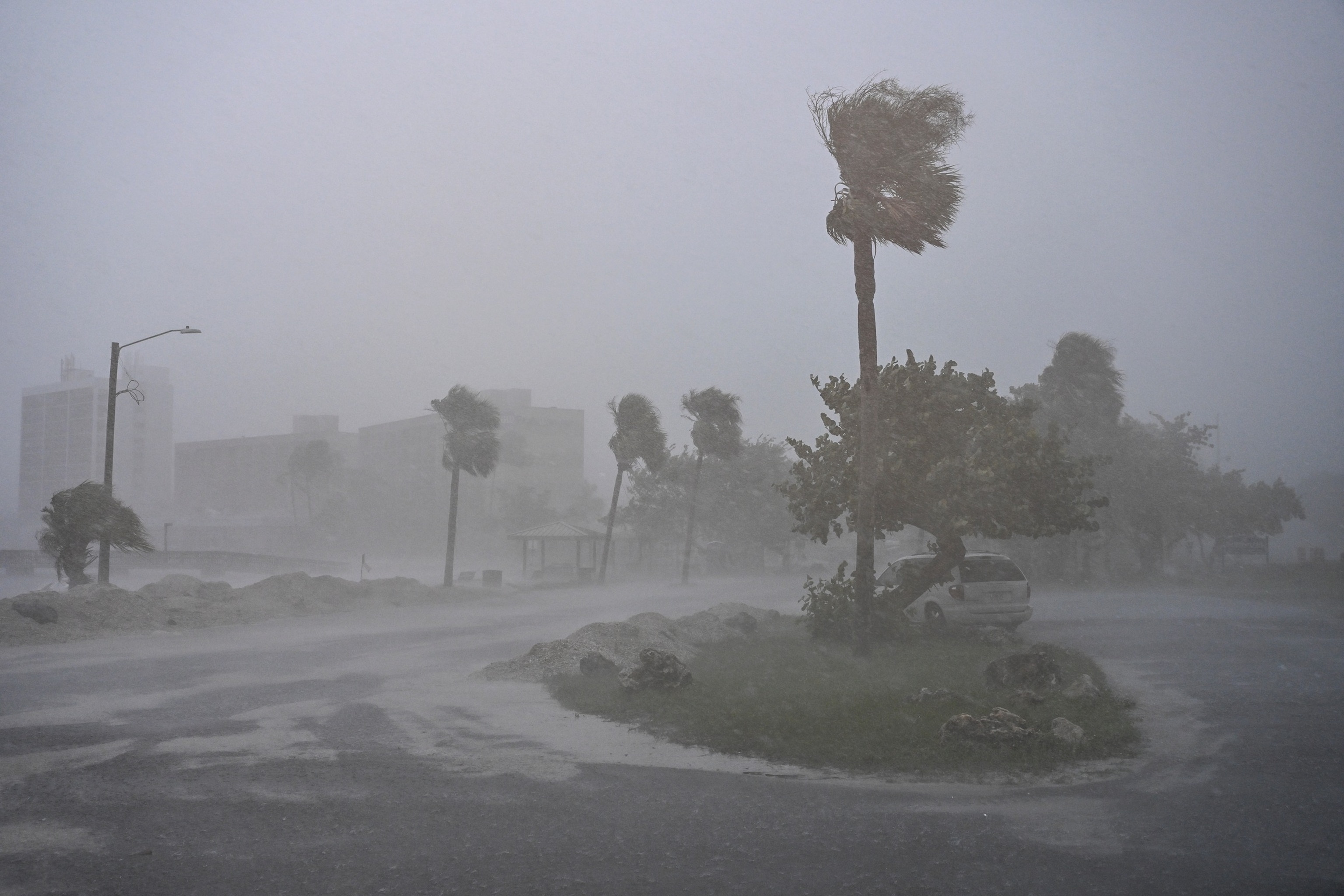
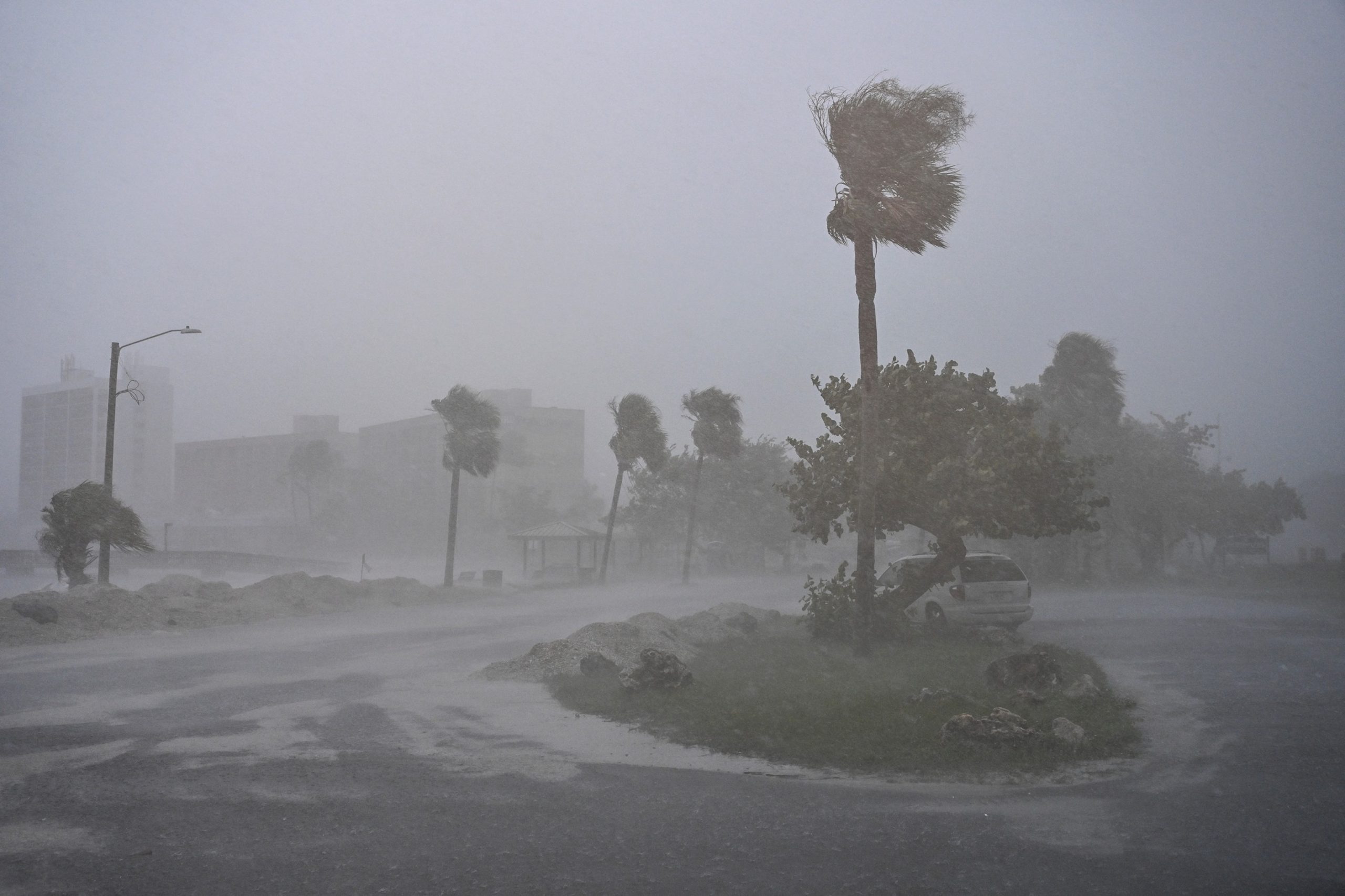
A car is seen parked as it rains heavily in Fort Myers, Fla., Oct. 9, 2024, as Hurricane Milton approaches.
Chandan Khanna/AFP via Getty Images
“When we got to the eye of the storm, it was still a Category 5 hurricane, and I watched it grow from tropical storm to a Cat-5 monster within two missions, which is the fastest I’ve ever seen anything rapidly intensify,” Rannenberg told ABC News’ David Muir on Wednesday.
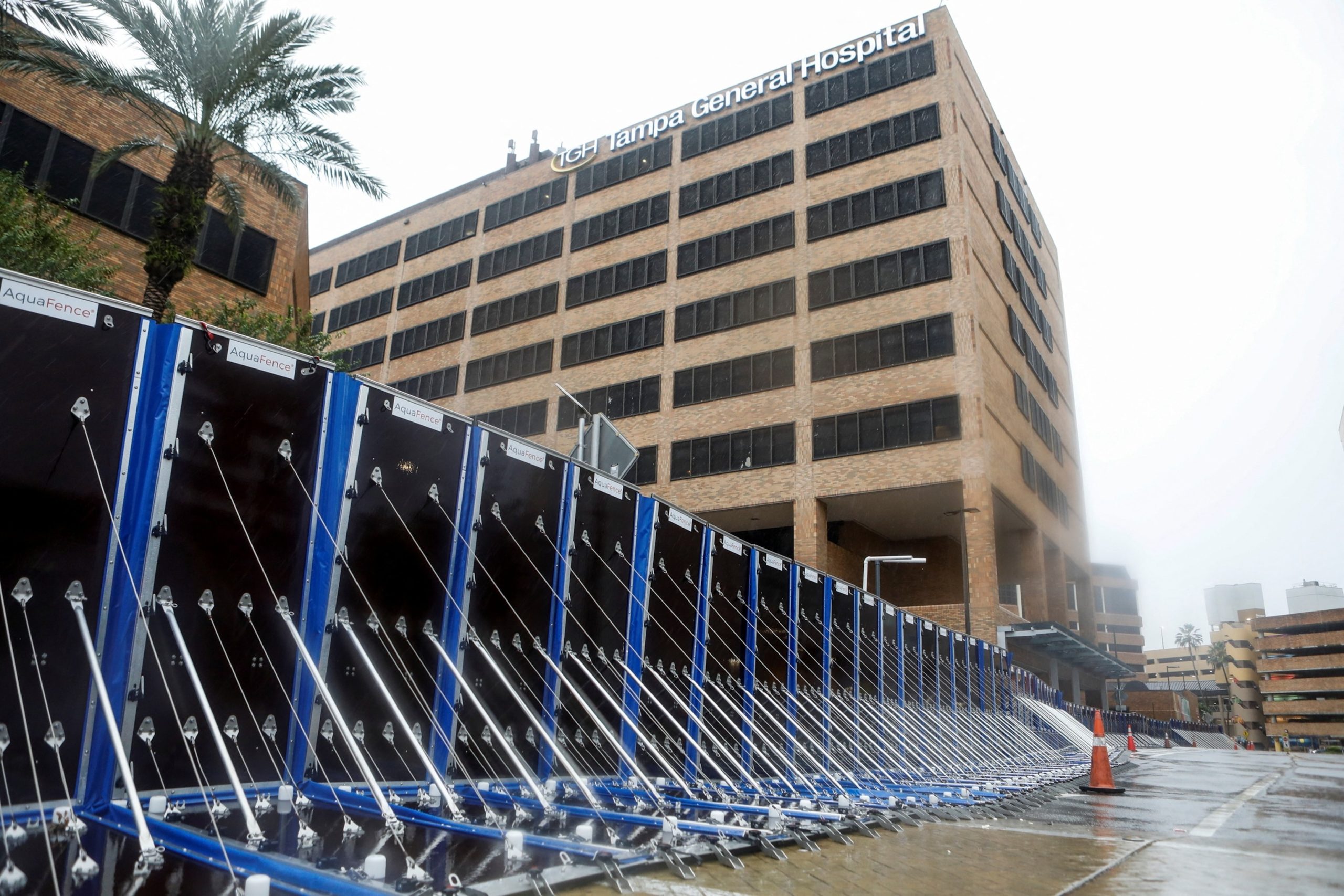
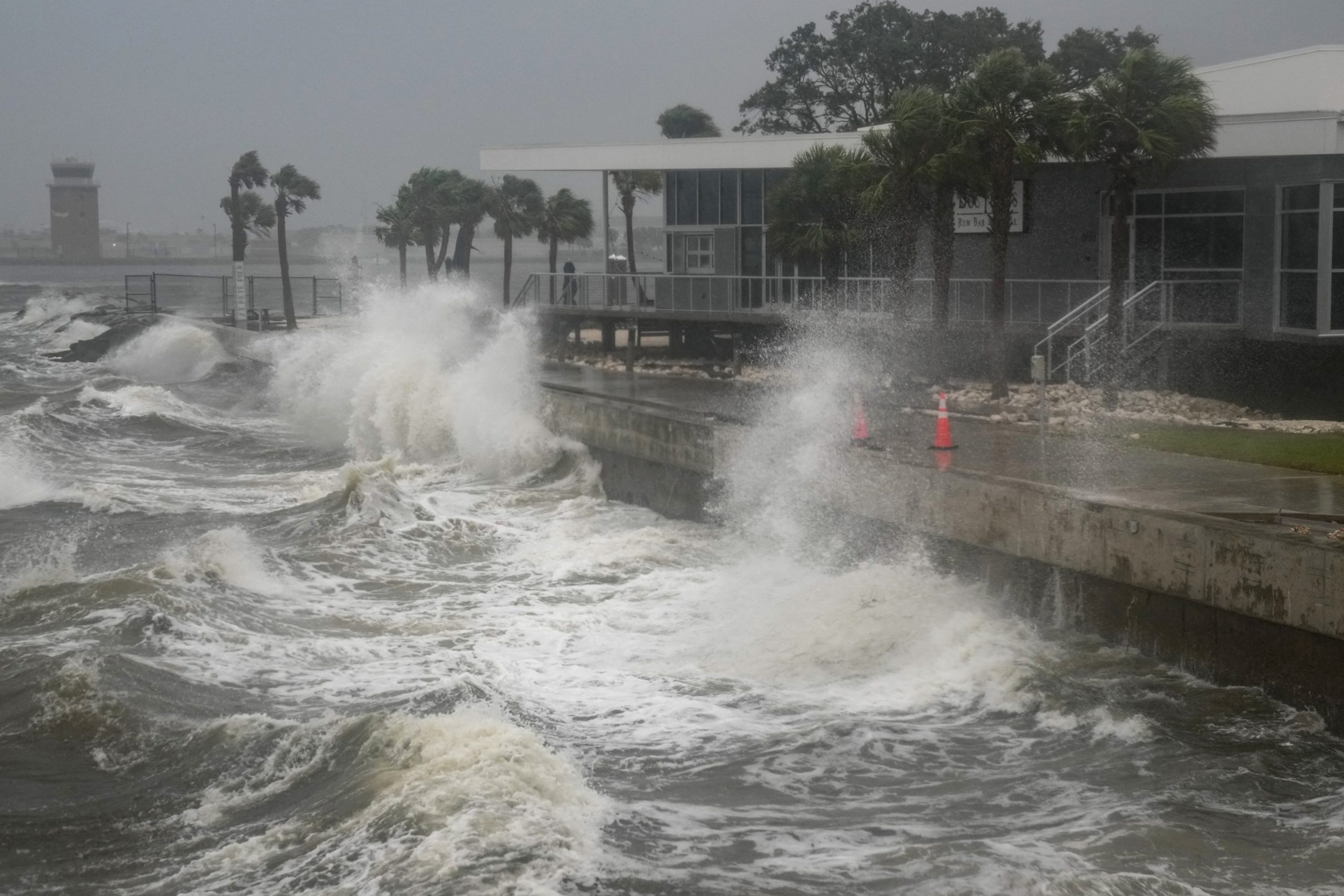
Residents were warned by the National Weather Service to shelter in place as Milton approached Florida’s west coast.
Its sustained winds have decreased to 120 mph, making it a high-end Category 3 storm. However, the storm has expanded and heavy rain is hitting much of the Florida peninsula, with tropical storm-force winds spreading inland. A recent wind gust of 68 mph was reported in Fort Myers Beach, Florida.
Rannenberg experienced what he calls the “stadium effect” as he flew into the eye of the hurricane, he told ABC News.
“When we were inside the eye, the eye of the storm was very hot, the air was much smoother, and the clouds kind of looked like a stadium building around us, and we were at 8,000 feet, looking all the way down to the ocean, and above us were cloud tops exceeding 55,000 feet,” he said. “So just towering clouds spinning around us inside the eye of the storm.”
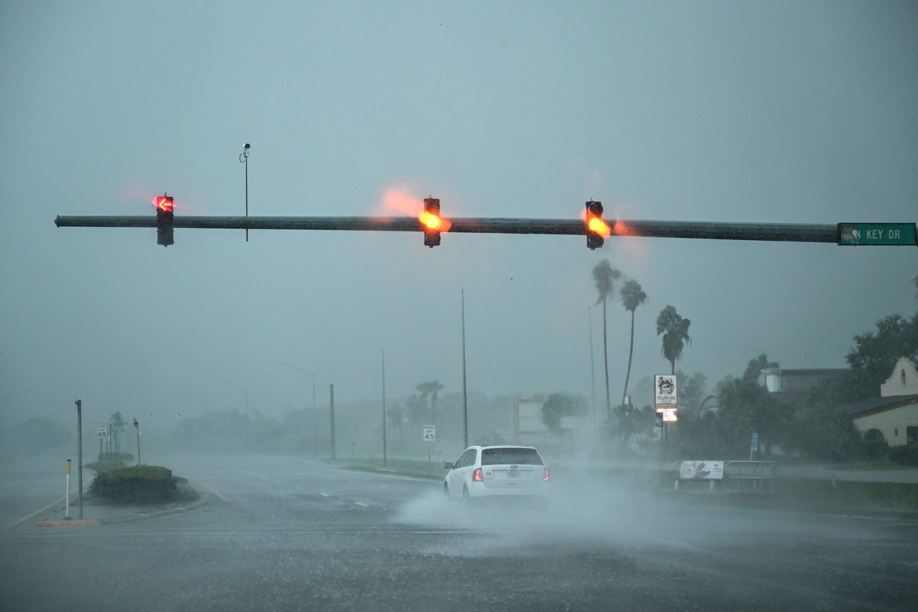
A car drives through the heavy rain in Fort Myers, Florida, Oct. 9, 2024, as Hurricane Milton approaches.
Chandan Khanna/AFP via Getty Images
Rannenberg has flown over numerous hurricanes over the years, but said Milton is on a different level.
“This is the craziest storm that I’ve ever flown inside of, hands down, multiple missions in a row, with the worst turbulence I’ve ever seen, the most lightning, the deepest convection, and just the breadth of the storm, the reach it has is incredible, as well as the power behind it,” he said.
As of 7 p.m. ET Wednesday, there were more than 293,000 customers without power across Florida ahead of Hurricane Milton’s expected landfall, according to poweroutage.us.
During an address on Wednesday, President Joe Biden discussed the imminent threat of Milton, which is projected to land on Florida’s west coast as a Category 3 storm.
“I urge everyone in Hurricane Milton’s path to listen to local officials and follow all the safety instructions they give,” Biden said. “At this point, evacuation is probably difficult, so I encourage people to look for safer shelter, sometimes moving just a few miles can mean the difference between life and death.”
Hurricanes are some of the most powerful and destructive natural phenomena on Earth, and understanding them is crucial for predicting their paths and potential impacts. Storm chasers play a vital role in this process, risking their lives to gather valuable data from within the eye of these massive storms.
One such storm chaser, Dr. Sarah Johnson, recently embarked on a daring mission into the eye of Hurricane Milton, a Category 4 storm that was barreling towards the coast of Florida. Dr. Johnson, a meteorologist and researcher at the National Hurricane Center, was part of a team of scientists and meteorologists tasked with gathering data to improve hurricane forecasting models.
As the team flew into the heart of the storm in a specially equipped research aircraft, they were met with fierce winds, torrential rain, and turbulent conditions. Despite the danger, Dr. Johnson and her colleagues remained focused on their mission, deploying instruments to measure wind speed, temperature, humidity, and other key variables.
One of the most striking insights from their mission into the eye of Hurricane Milton was the phenomenon known as the “stadium effect.” This occurs when the eyewall of a hurricane forms a circular wall of clouds around the eye, creating a stadium-like shape. Dr. Johnson and her team were able to capture stunning images and video footage of this unique feature, providing valuable data for researchers studying hurricane dynamics.
In addition to the stadium effect, Dr. Johnson and her team also observed rapid changes in wind speed and direction within the eye of the storm. These fluctuations can have a significant impact on the intensity and path of the hurricane, making them crucial factors for forecasters to consider.
By braving the elements and venturing into the eye of Hurricane Milton, Dr. Johnson and her colleagues were able to gather invaluable data that will help improve our understanding of these powerful storms. Their insights will be used to refine forecasting models and better predict the behavior of future hurricanes, ultimately helping to save lives and protect communities in the path of these destructive forces.
As hurricane season continues to bring powerful storms to coastal regions around the world, the work of storm chasers like Dr. Sarah Johnson remains essential in advancing our knowledge of these complex weather systems. Their dedication and bravery in the face of extreme conditions are truly commendable, and their insights from missions like the one into Hurricane Milton will continue to inform our understanding of these formidable natural events.