Heavy rainfall is in the forecast for the Northeast, while severe thunderstorms could bring tornadoes, large hail and damaging winds to the South.
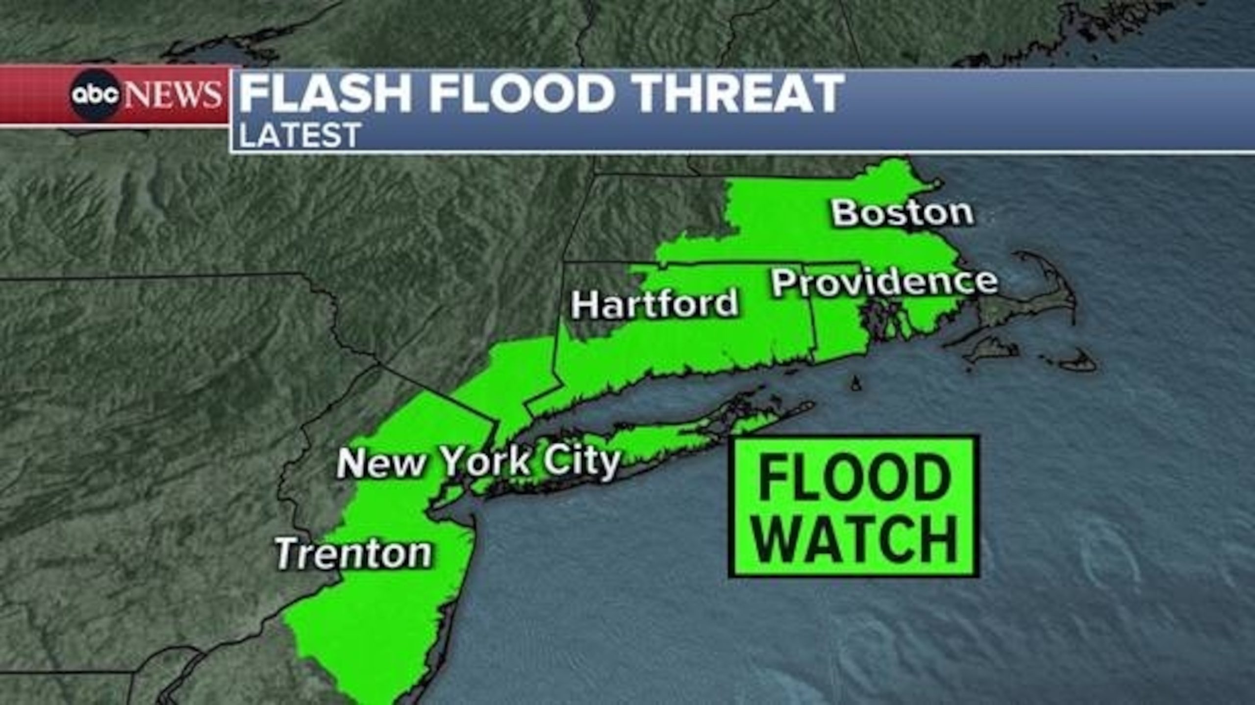
The National Weather Service has issued a flood watch from New Jersey to Massachusetts for Wednesday afternoon into Thursday, warning that heavy rain could cause flash flooding.
Major cities under the flood watch include New York City, Hartford, Providence and Boston.
Localized rainfall amounts of 3 inches is possible within this short period of time, which would trigger urban flash flooding.

The March 6, 2024 weather map shows the latest flash flood threat.
ABC News
The rain is expected to begin early Wednesday afternoon and continue into the evening for most of the Northeast.
Then the rain is forecast to linger over New England into Thursday afternoon.
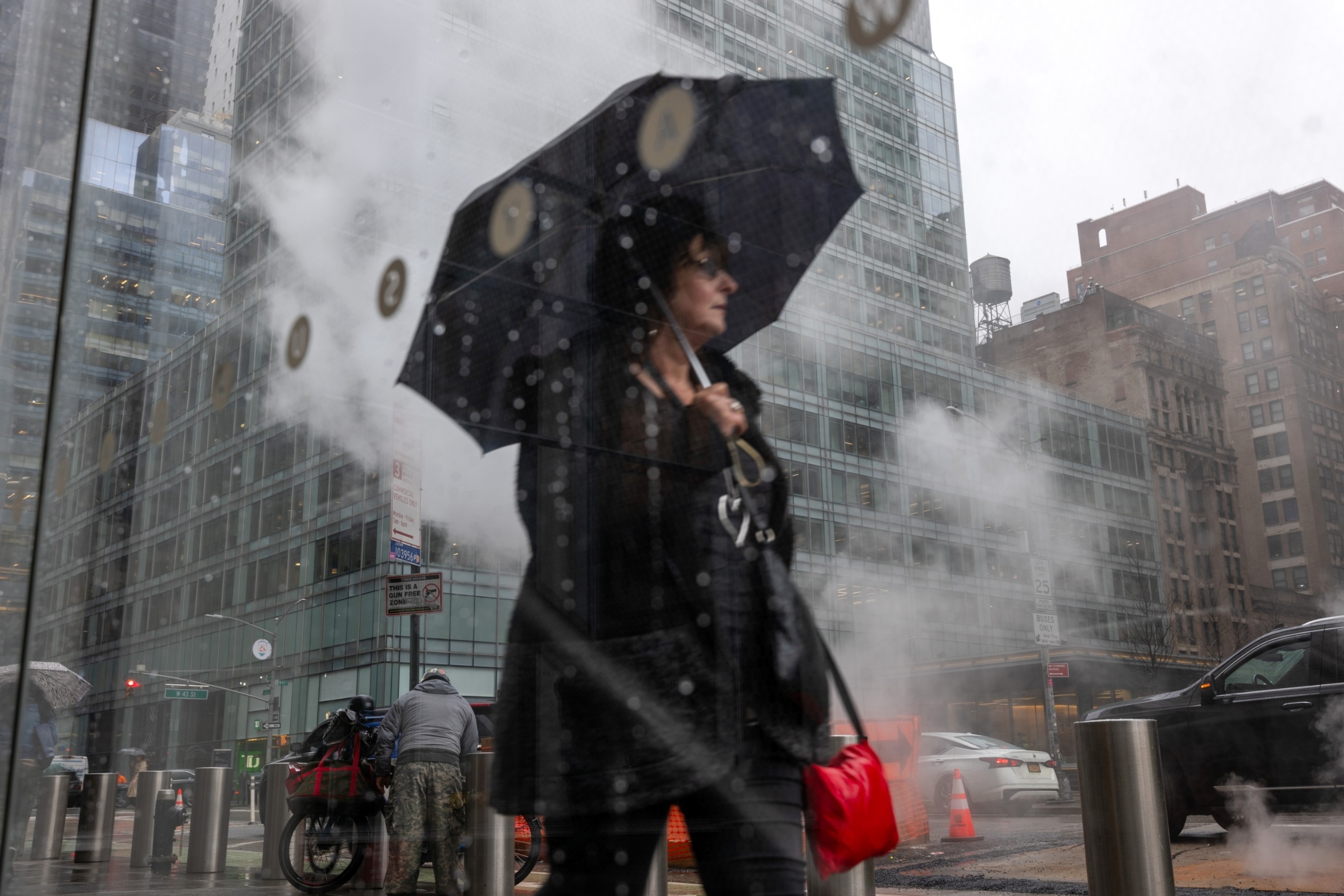
People walk through the rain in midtown Manhattan on March 05, 2024 in New York City.
Spencer Platt/Getty Images
Friday is expected to bring a respite from the rainfall before more heavy downpours come over the weekend with yet another storm.
The rain is forecast to begin Saturday evening for the Interstate 95 travel corridor and continue into Sunday morning.
Snow is expected to fall over the mountains of upstate New York and northern New England from Saturday night into Sunday, with more than a foot possible locally. There could be additional flooding on Saturday night due to a very saturated ground.
There is also a threat for flash flooding across the South, from the Carolinas to Georgia. The National Weather Service has issued a flood watch for North Carolina’s Outer Banks barrier islands.
Meanwhile, severe thunderstorms are forecast to begin in parts of Texas on Thursday morning before moving into the Dallas metropolitan area. More severe weather is expected that night in areas of Texas and Oklahoma, including the Dallas-Forth Worth metroplex. The biggest threat there will be large hail, but the possibility of an isolated tornado or damaging winds can’t be ruled out.
The severe weather is expected to move further east on Friday into eastern Texas, Louisiana, Mississippi, Alabama and the Florida Panhandle. The biggest threat there will include tornadoes, damaging winds, hail and flash flooding.
On Tuesday, thunderstorms swept across the South and even the Midwest, with two landspout tornadoes reported in Texas and Ohio. The storms also brought heavy rain to Atlanta on Wednesday morning, prompting the National Weather Service to issue a flash flood warning there.
The Northeast region is currently on flood watch as heavy rainfall continues to drench the area, leading to concerns of potential flooding in low-lying areas. The National Weather Service has issued flood warnings for several states in the region, including New York, New Jersey, and Pennsylvania.
The heavy rainfall is a result of a slow-moving weather system that is bringing moisture from the Gulf of Mexico up the East Coast. This system is expected to linger over the region for the next few days, increasing the risk of flooding in areas that are already saturated from previous storms.
Residents in the Northeast are being urged to stay informed about weather conditions and to take precautions to protect themselves and their property from potential flooding. This includes avoiding driving through flooded areas, securing loose outdoor items, and having an emergency kit with supplies on hand.
Meanwhile, in the South, residents are preparing for severe thunderstorms that are forecasted to bring damaging winds, hail, and possibly tornadoes. The Storm Prediction Center has issued a severe weather outlook for several states in the region, including Texas, Louisiana, and Mississippi.
Residents in these areas are being advised to stay alert to changing weather conditions and to have a plan in place in case severe weather strikes. This includes knowing where to seek shelter, having a way to receive weather alerts, and staying informed about local evacuation routes.
As climate change continues to impact weather patterns across the country, it is important for residents in all regions to be prepared for extreme weather events. By staying informed and taking proactive measures to protect themselves and their property, individuals can help mitigate the impact of severe weather and stay safe during these challenging times.